Yes, the Arctic National Wildlife Refuge is open to the public. There’s no entrance gate, no permit required for general visitation, and no fee. Most visitors reach the refuge by flying in from Coldfoot or Arctic Village on the south side, or from Kaktovik on the Beaufort Sea coast on the north side. Some access by river, and a few walk in from the Dalton Highway. The refuge is wilderness without developed facilities, roads, or trail systems. The U.S. Fish and Wildlife Service refuge page has the official visitor orientation.
Standard access points
The most common ways into the refuge are:
Coldfoot (south side). On the Dalton Highway. Charter operators fly into the refuge from here. Easy to combine with a Dalton Highway road trip.
Arctic Village (south side). Iñupiat village in the Brooks Range, accessed by air from Fairbanks. Charter operators based here fly into the southern half of the refuge.
Fort Yukon (south side). Larger Gwich’in community, also reached by air from Fairbanks. Some charter access into the refuge.
Kaktovik on Barter Island (north side). Iñupiat village on the Beaufort Sea coast. The standard launch point for trips into the northern part of the refuge, including coastal polar bear viewing.
Walking in from the Dalton
You can walk west into the refuge from points along the Dalton Highway, particularly in the Atigun Pass area. There’s no trail. You’re in roadless tundra and willow brush from the moment you leave the road. People do this. Most don’t, because the experience-to-effort ratio is steep and bush charters give you a lot more country for the time and money.
River access
Several rivers run through or out of the refuge. The Canning, Hulahula, Kongakut, Sheenjek, and Coleen are all paddled or floated by experienced parties. Most are fly-in trips, with bush charters dropping rafts or packrafts at the headwaters and picking up at takeout. The Hulahula and Kongakut are the most-paddled coastal rivers in the refuge. The Sheenjek and Coleen are interior rivers from the south side.
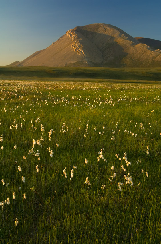
What visiting looks like
Visiting ANWR is a wilderness expedition, not a sightseeing trip. There are no campgrounds, no rangers stationed in the field, no toilets, no signage. You bring everything in and pack everything out. You handle your own safety. Cell coverage is nonexistent. Communication is by satellite messenger or sat phone.
Guided trips into ANWR are available for visitors who want the experience without handling the full logistics, including coastal polar bear photography from Kaktovik and inland backpacking and packrafting expeditions. Independent travel works if you have the experience.
What “fly-in” can actually look like
A few years back we had a backpacking group on our Above the Circle trip into the refuge. They got delayed by weather for two days in Coldfoot, waiting for the pilot to be able to fly.
When they finally got out, the pilot couldn’t reach the strip they had originally planned for. He landed them well east of the intended drop, with two days less on the trip and considerably more country to cover than they had bargained for. Trying to complete the original route wasn’t going to work. They turned and walked east instead, sight unseen, no scouting, working off some pilot beta and a hand-drawn map. We coordinated with the group from the office on a satellite messenger, and the route they ended up doing wasn’t the one anyone had pictured but it worked. The weather wasn’t great. Everyone had a good time. That’s a typical ANWR trip story. Plans bend, plans change, you adapt.