The Arctic National Wildlife Refuge is 19.286 million acres, roughly the size of South Carolina. It’s the largest national wildlife refuge in the United States by a wide margin, and one of the largest protected wilderness areas in the world. For comparison, Wrangell-St. Elias National Park (the largest U.S. national park) is 13.2 million acres, and Yellowstone is 2.22 million acres. ANWR is bigger than both combined.
Scale comparisons
Numbers at this scale don’t mean much without comparison. Some useful reference points:
ANWR is approximately the size of South Carolina. Slightly smaller, but in the same range.
It’s roughly the size of nine Yellowstone National Parks (Yellowstone is 2.22 million acres).
It’s about 50% larger than Wrangell-St. Elias, which is the largest national park in the U.S. system.
It’s larger than Switzerland.
What’s inside that area
Most of the refuge is roadless wilderness. The land transitions across multiple ecosystems south to north:
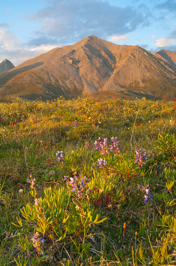
The boreal forest in the south, around the Brooks Range foothills and the south flank of the range.
The Brooks Range itself, running east to west across the middle of the refuge. The Romanzof Mountains and the Davidson Mountains are the highest sub-ranges.
The Arctic foothills on the north side of the range.
The Arctic coastal plain (often called the “1002 area” because of its designation in ANILCA), running from the foothills to the Beaufort Sea coast.
The Beaufort Sea coastline, including barrier islands like Barter Island where Kaktovik sits.
Within these zones live the Porcupine Caribou Herd (one of the largest caribou herds in North America), polar bears along the coast, grizzlies and black bears in the interior, musk ox, dall sheep, wolves, and the bird life that funnels in for the brief Arctic summer breeding season.
How that scale shapes a visit
A trip to ANWR covers a tiny fraction of the refuge no matter how ambitious. A 10-day backpack covers maybe 60-80 miles of country. A two-week river trip floats one river out of dozens.
Most visitors who come back for a second or third trip pick a different river, a different drainage, a different season, and end up with completely different country each time.
For the official acreage, boundary maps, and management context, the USFWS Arctic Refuge page is the authoritative source.
When the scale hits you
The scale of the refuge hit me on my first trip. We flew from Happy Valley on the Dalton Highway across to the Marsh Fork River. Several hours of flying. When we landed, we were at the western edge of the refuge. Several hours of flying just to get to the edge.
Once you’re on the ground, you’re in a single river valley with mountains close on either side, and you don’t really feel the scale anymore. So that first afternoon my buddy and I scrambled up an unnamed peak above camp and sat on top of it late in the evening. Mountains in every direction. Brooks Range running east as far as we could see, and west the same. That’s when the scale of the refuge actually registered. From the ground in a valley you can’t see it. From a high point in the right light, you can.