To get to the Arctic National Wildlife Refuge, fly from Fairbanks or Anchorage to one of the gateway villages: Coldfoot, Arctic Village, Fort Yukon, or Kaktovik. From there you charter a bush plane into the refuge itself. There are no roads into the refuge. The Dalton Highway runs along its western edge but doesn’t enter it. Most trips are fly-in, fly-out backcountry expeditions or coastal trips out of Kaktovik.
The standard chain
Step one is getting to Fairbanks (or Anchorage for Kaktovik trips). Daily commercial flights run from the Lower 48 to both.
Step two is the connection to a gateway community. From Fairbanks, you fly small commercial to Coldfoot, Arctic Village, Fort Yukon, or Bettles. From Anchorage you connect through Fairbanks for most refuge entry points; Kaktovik is reached from Fairbanks via Deadhorse on Wright Air or other carriers.
Step three is the bush charter into the refuge proper. Operators like Coyote Air (Coldfoot) and others handle drop-offs on gravel bars, tundra strips, and small lakes inside the refuge. The bush flight is what gets you into actual wilderness.
Side gateway: Kaktovik on the coast
Kaktovik on Barter Island is the standard launch point for the Beaufort Sea coast and the northern part of the refuge. Reached by air from Fairbanks via Deadhorse. Land-based access into the inland refuge from Kaktovik is possible but most coastal trips stay coastal.
The Dalton Highway option
You can drive the Dalton Highway from Fairbanks to Atigun Pass and points north, getting you parallel to the refuge’s western boundary. From the highway you can walk east into the refuge across roadless tundra. The walk is harder than it looks, the same way walking into Gates of the Arctic from the Dalton is. No trail, no entry station, no sign.
River trips
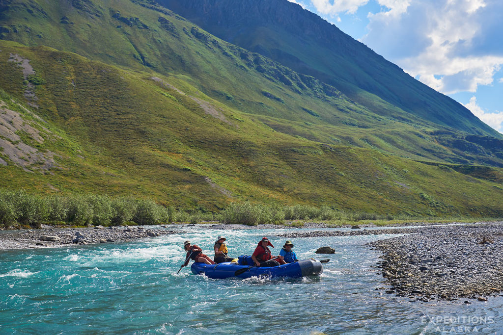
The Hulahula, Kongakut, Canning, Sheenjek, and Coleen rivers all flow through or out of the refuge and are the standard objects of refuge raft and packraft trips. Bush charter drops at the headwaters, you float to a takeout, charter picks you up. The Hulahula and Kongakut are coastal-bound (north slope) and the Sheenjek and Coleen are interior (south side).
Backpacking trips
Backpacking is the other main way to travel the refuge interior. The logistics mirror river trips. You either walk in from the Dalton Highway across roadless tundra, or you fly in from Coldfoot or Arctic Village by bush charter. Drop-off and pickup spots are arranged with the air taxi — same operators who handle river trip logistics. There are no developed strips, so you’re landing on gravel bars, tundra benches, or small lakes.
What it costs
The bush charter is the biggest single cost on a refuge trip. Plan for it. Operators charge by the flight, not the person, so larger groups bring per-person costs down. Total trip cost depends on how far in you fly, how long you stay, and whether the charter has to make multiple trips for gear.
Guided refuge trips handle all of the above, including bush charter logistics. For independent travel, contact the charter operators directly and book early; summer slots fill. The USFWS planning page for ANWR visits has the official guidance for independent visitors.
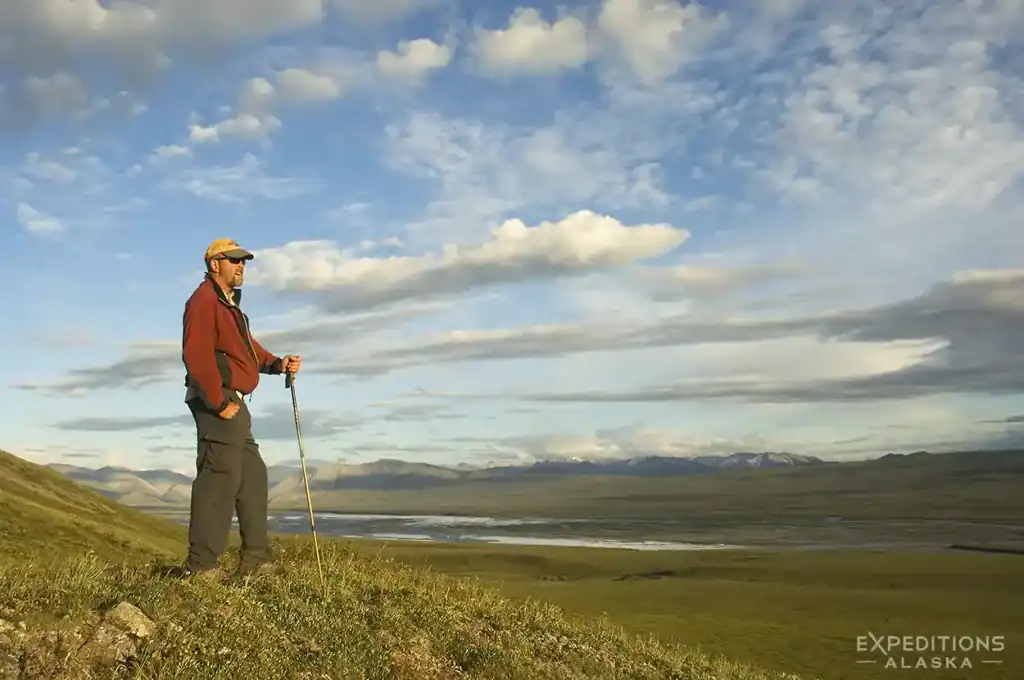
What a refuge trip actually looks like
My first trip to ANWR was 2004. A friend and I drove from Fairbanks all the way up the Dalton Highway to Coldfoot, then north another stretch to Happy Valley, about 80 miles south of Deadhorse. We met a pilot named Tom there who flew us in to the upper Marsh Fork landing strip near the continental divide. From there we rafted about 150 miles. Down the Marsh Fork through the Brooks Range, into the Canning, out through the foothills onto the coastal plain, and out the Staines River to the Beaufort Sea. We camped on the beach at the end.
ANWR is an Arctic desert, so it doesn’t rain much, but the temperature swings are real. We saw musk ox for the first time ever on that trip. First Arctic fox. Waterfowl and raptors most days.
That’s a fairly typical ANWR pattern. Drive or fly to a road or village access point, bush charter into the headwaters of a river, multi-day float through changing country to the coast or to a takeout. Pieces vary, but the shape stays similar.