Wrangell-St. Elias Backpacking Trips

Wrangell-St Elias doesn't care if you're ready. Real wilderness, genuine solitude, and mountains that rearrange your understanding of scale.


  • Biggest National Park in the World
  • Biggest Mountains in the Country
  • Tallest Coastal Mountain Range in the World
  • Most Glaciated Park in the Country
  • 2nd Largest River in the Country
  • Carl's Favorite Place. EVER

You’ve probably never heard of Wrangell-St. Elias National Park.

Not enough people know about Wrangell-St. Elias National Park. Far too few.

Even fewer still have considered backpacking here.

Most have never heard of it. You’ve heard of Denali. You’ve heard of Gates of the Arctic. You’ve heard of the Inside Passage.

What is this Wrangell-St. Elias? And why does it have so many names?

The BEST Backpacking in Alaska

I know, I know, everyone wants to go to the arctic. Everybody thinks Denali is the tallest mountain in the country so “we should go there”. Everybody thinks Gates of the Arctic “sounds” cooler.

They’re awesome backpacking places, for sure.

But they’re not Wrangell-St. Elias.

Our wilderness explorations here are simply unparalleled. For really great backpacking and hiking, there’s no place quite like it.

Or close.

Whether you’re looking for a personal trip, or a guided backpacking trip with some of the best backpacking guides in the state, I hope this page and related resources helps you out.

Read on 👇

Some Simpler Trips

Types of Trips

Backpacking trips in Wrangell-St. Elias fall into a few general categories, though there’s some overlap.

Basecamp Trips

Fly into a remote location, set up a basecamp, and spend the week doing day hikes from that camp. This allows you to explore an area without carrying a full pack every day. You can leave heavy gear at camp and move light.

Basecamp trips work well for photography, for groups with varied fitness levels, or for areas where the terrain makes traverses difficult.

Basepacks

A term you’re probably not familiar with. We’re the only folks that use it, but we like it. A combination of basecamping and backpacking. Fly-in, land, camp, hike a couple days, move camp a day, do it again, repeat and make your way back to the landing trip for your pickup.

They’re a little more adventurous than a basecamp and not so hardy as a traverse. But a great way to see the landscape.

Traverses

Fly into one location, hike to another location, fly out. These are point-to-point routes, often 30 to 50 miles over a week. You carry everything with you. You move camp every day or every other day.

Traverses cover more ground and offer more variety in terrain and scenery. They’re also more demanding. Every day involves breaking camp, packing up, and hiking with a full load.

Super hard to classify by difficulty. Any route you do here is going to have some degree of “Alaska” in it somewhere. It might be a short scree slope, it might be a mile or 2 of “ouch” .. but it’s there.

Loops

Less common in Wrangell-St. Elias due to the terrain, but some backpacking routes allow you to return to your starting point without retracing your steps. Loops require careful planning and often involve difficult river crossings or glacier travel.

“Out-and-backs” are more common and really, a more practical approach here. Kind of like a basepack trip above.

Access and Logistics

Most backpacking trips in Wrangell-St. Elias begin with a bush plane flight. There are two main access points.

McCarthy

McCarthy is a small community on the west side of the park, accessible by the McCarthy Road. Bush planes operate out of McCarthy and fly into various parts of the park. The flight itself is part of the experience. Single-engine planes, gravel landing strips, pilots who know the terrain.

McCarthy has limited services. A few lodges, a small store, a couple of restaurants. You’ll arrange lodging before and after your trip. Most trips fly out of McCarthy in the morning and return in the late afternoon or evening.

How do we run our McCarthy based trips?

This page outlines how we structure McCarthy based backpacking trips.

Nabesna

The Nabesna Road provides access to the north side of the park. It’s a rough road, 42 miles of gravel, ending at the old mining area of Nabesna. From there, you can hike into the backcountry without flying. This makes Nabesna-based trips less expensive, but it also limits where you can go.

Nabesna sees even fewer visitors than McCarthy. There are no services beyond the ranger station at the road’s end. You’re truly remote.

Nabesna doesn’t get the visitors that McCarthy does, but that’s primarily because it doesn’t have (a) Kennicott mine, and (b) the infrastructure that McCarthy does. But it’s an excellent place to visit and start your backcountry adventure.

Yakutat

A 3rd option is to enter the park via Yakutat. There are both air and water taxis available there. They can get you to some astonishing locations. Of all the places we visit in this park, the locations we explore via Yakutat area get the fewest visitors.

I’ve seen MAYBE 2 other backcountry visitors in the nearly 20 years I’ve been running these Yakutat-based trips. Whether you want to walk the coast, explore the Malaspina Glacier or poke around Icy Bay, this region is just awesome. Awesome.

Air Taxis

Bush pilots in Alaska are not just transportation. They’re your safety net. They know weather patterns, landing strip conditions, and what routes are feasible. They’ll tell you if a strip is too rough for a loaded plane or if the weather is marginal.

The relationship with your air taxi matters. These are small operations run by people who’ve been flying in the area for decades. Wrangell Mountain Air, for example, has been operating out of McCarthy for over 40 years. Copper Valley Air on the northside of the Park, and Devil Mountains Lodge at Nabesna, similarly so. These are the people you want to fly with here.

Flights are weather-dependent. If conditions are bad, you wait. Be prepared for this. Flexibility is required. You might fly out a day early or a day late depending on weather windows.

Pro Tip #2

  • Doublecheck you have the exact GPS location for your backcountry pickup with the air taxi. Those little tiny gravel strips can be way harder to find when you’re on the ground than you think they will be. Many a backpacker has spend hours looking for a strip.
  • If you can, have your pilot show you some of the route from the air on your flight in. It’s not always possible but it’s a blessing when you get the chance.

When To Go

The backpacking season in Wrangell-St. Elias is short. Snow lingers into June at higher elevations. It returns in September. The practical window is July through early September.

June

For much of the park, this is pre-season. But some gems are available here. The Lost Coast area, down by Malaspina Glacier and Icy Bay, is open early. Some of the north side of the park is open, including heart of the Park by Copper Glacier.

You can also explore right from the Nabesna Road on the trail system like Lost Creek Trail and Trail Creek. These trips offer early season accessibility, at lower cost since they do not involve an air taxi. It’s not super far to amble up to the high country from here, and the trails are followable. A good route-finder and adventurous hiker can put together some great loops up here.

July

Early season. Snowpack is melting, which means higher water in glacial rivers. River crossings become more difficult. Days are long, with nearly 20 hours of daylight. Mosquitoes are thick at lower elevations. Wildflowers are at their peak in alpine zones.

Temperatures are generally mild, though weather is always variable. Rain is common.

August

Peak season. Rivers drop as the melt pulse slows. River crossings are generally easier than in July, though they’re still cold and challenging. Days are shortening, but you still have 16 to 18 hours of light. Mosquitoes decline. Blueberries ripen.

August tends to be colder and wetter than July, but that can vary 180 degrees any given summer. Temperatures generally remain moderate; but it’s not uncommon to see freezing temps come mid August. Bring your puffy.

September

Late season. Days shorten quickly in Wrangell-St. Elias. By mid-September, you’re down to 12 to 13 hours of daylight. Nights are cold. First snows can hit higher elevations. Fall colors appear in the tundra.

Rivers are at their lowest, making crossings easier. Mosquitoes are gone. Berries are everywhere. Bears are active, feeding heavily before denning.

September weather is unpredictable. You might get clear, stable days. You might get prolonged storms. Be prepared for both.

Air taxi accessibility becomes less predictable. It’s rare that you’ll schedule a flight, say, to Skolai Pass after Sept 15. Lower elevations are still good.

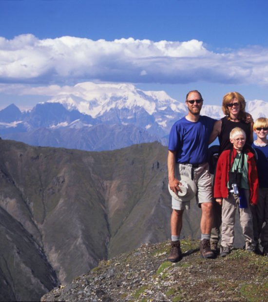
Difficulty and Experience Required

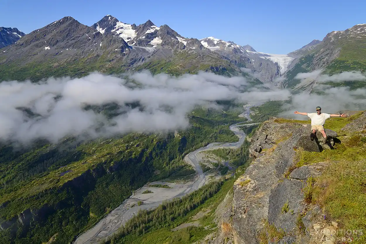
Wrangell-St. Elias is not a good place to learn backpacking. The remoteness, the lack of trails, the river crossings, the weather variability, the navigation demands; all of it assumes competence.
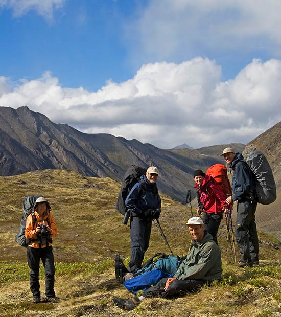
Fitness

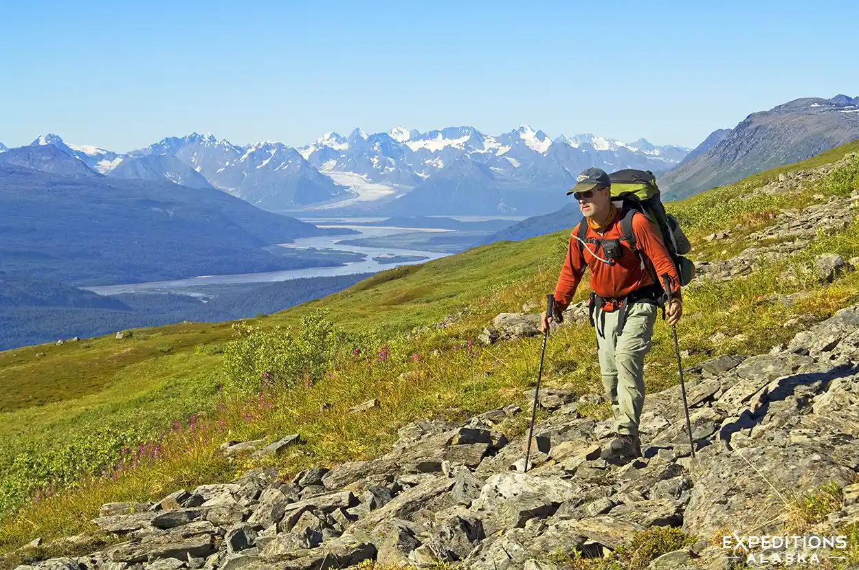
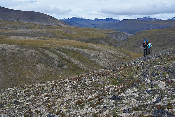
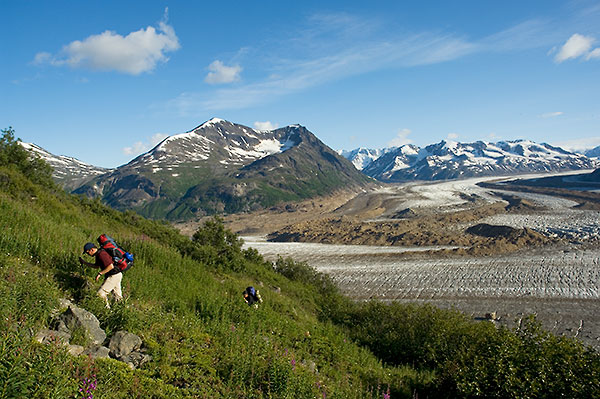
You’ll hike 5 to 8 miles per day with a 40- to 60-pound pack. That doesn’t sound like much compared to trail hiking, but the terrain slows you down. Tussocks, scree, alder, uneven ground; it makes for slow miles. Expect 6 to 10 hours of hiking per day, including breaks.

Elevation gain and loss is constant. Even routes described as “gentle” involve climbing and descending. Your knees and ankles take a beating.

If you can’t comfortably carry a loaded pack for multiple days over rough terrain, the Wrangells aren’t for you yet. Build your fitness elsewhere first. Or pursue a basecamp or basepack trip.

Navigation Skills

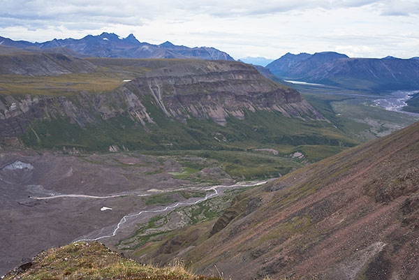
Trail-less travel requires the ability to read terrain and make route decisions. You need to be comfortable with map and compass. GPS helps enormously. It’s not a replacement for understanding where you are and where you’re going.

You should do a lot of research on your route before hitting the backcountry.

If you’ve only hiked on trails, you probably don’t have the skills for independent travel in Wrangell-St. Elias. That’s not a judgment. It’s a caution. Trail-less navigation is a skill that takes time to develop.

Guided trips solve this problem. The guide handles navigation. Follow them.
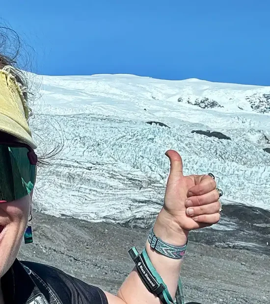
River Crossings

Glacial rivers are cold, fast, and opaque. You can’t see the bottom. Crossings require judgment and technique. Not every crossing is dangerous, but some are. All of them can be. Knowing the difference matters.

If you’ve never crossed a glacial river, you’ll learn on a guided trip. If you’re going independently, you should have prior experience with river crossings in similar conditions.
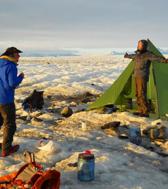
Self-Sufficiency

You’re days from help. There are no backcountry ranger stations. No emergency shelters, no other hikers to assist if something goes wrong. Carry a satellite communicator, a first aid kit, and the knowledge to use both.

Problems that are minor inconveniences near civilization become serious issues in the backcountry. A sprained ankle, a bout of food poisoning, equipment failure; here it has to be managed with what you have.

If the idea of that level of self-reliance makes you uncomfortable, hire a guide.

Weather

Weather in the Wrangells is variable and often harsh. You’ll get rain. You might get multi-day storms. Wind is common at higher elevations. Temperatures range from the 30s to the 60s, sometimes within the same day.

What to Expect

Mornings are often clear. Clouds build through the day. Rain or snow in the afternoon and evening. The pattern isn’t reliable, but it’s common.

Storms can settle in and stay for days. This is Alaska. big wet low pressure systems ooze in from the Pacific and they hang around. And around.

You can’t count on good weather. Plan for wet conditions and be pleasantly surprised if you get sun.

Layering Is a Verb

Temperature regulation is constant. You’ll add and remove layers throughout the day. Stop, rinse and repeat.

Mornings start cold. Hiking warms you up. Breaks cool you down. Evening is cold again.

Rain Gear

Rain gear gets used. A lot. Waterproof shell, waterproof pants, pack cover or dry bags inside your pack. Wet gear is part of the experience.

Cold is manageable if you stay dry. Wet and cold together will make you miserable and hypothermic. Prevention matters more than toughness.

Pro Tip

Most folks who backpack in the Lower 48 don’t carry a cook tent, or cook tarp. We NEVER go out without one. Specifically what we bring varies with group size. But we always bring one.


Always.


Why?

Because we don’t eat in our tent. This is grizzly bear country. Meals are always taken a good distance from camp; 100 yards is a good start. After dinner food and kitchenware is stored a good distance from the dining room. Having some form of shelter to eat under makes a HUGE difference.

Oz

There’s a reason we call it “Land of Oz”.

Hidden Valley is a Gem.

And Oz is like 2 Gems

A Short Walk.

Just Enough. Just Right.

🥾🥾

Amble Through Oz With Us 

The Goat Trail

More aptly named, the GOAT Trail.

Greatest Of All Time.

Off The Beaten Trail. Never Beaten.

The First Route I Ever Backpacked in Alaska.

Choose Wisely.

🥾🥾🥾

Trek the Goat Trail 

Seven Pass

The Trip of Ages.

Two Glaciers. Multiple Passes.

Backpacking at its Finest.

Challenging, but not Beyond.

🥾🥾🥾🥾

Welcome to our Seven Pass Route .

The Southern Traverse

Welcome to Cliffside.

Our Gnarliest, Most Challenging Venture in the Park.

Nobody Else Does This Route.

Redefine “off-trail” hiking.

There’s Nothing Like it. Anywhere.

🥾🥾🥾🥾🥾

Wanna Come For A Walk? 

Why we love this place

I’ve explored, to some degree, wild places in much of Alaska. I’ve poked my nose into southeast, I’ve ambled around Arctic National Wildlife Refuge, gone to Gates and done Denali.

I spend a lot of time in Katmai National Park.

They’re all incredible.

But they’ll never just rock my world like Wrangell-St. Elias National Park does.

Secret tip: for river trips, I’d head north.

Gates and the Arctic National Wildlife Refuge win. Hands down. Ironically, the water is (typically) warmer in this rivers than it is in Wrangell-St. Elias National Park.

But if you want to keep your feet on the ground?

Go to Wrangell-St. Elias National Park.

From The Blog

Wrangell-St. Elias National Park backpacking trips, SteamboatHills, Alaska.

Wrangell–St. Elias National Park & Preserve in Alaska is a sprawling wilderness of glaciers, high peaks, rivers, and remote ecosystems. This overview covers its geography, natural features, wildlife, and visitor access points.

The Heart of the Park, Wrangell St. Elias National Park backpacking trip.

Where in Alaska do YOU want to backpack? For me, it’s everywhere at once. If the weather is good.But my absolute Number one, FAVORITE place? .. read on ..

Hidden Creek valley, in the Wrangell mountains. A popular backpacking route, Hidden Creek in the Wrangell Mountains is a wonderful hike. Wrangell - St. Elias National Park and Preserve, Alaska.

Dawn light on the Wrangell Mountains and reflection in an alpine tarn near Hidden Creek and the Lakina River, Wrangell-St. Elias National Park and Preserve, Alaska.

Mt Sanford, Sanford Plateau backpacking trip, Wrangell-St. Elias National Park, Alaska.

Hey Folks Off-trail backpacking It doesn’t mean what you might think it means. What do we mean, here in Alaska, when we say “off-trail’? Well, what we mean is “no trail”. It’s not the same thing as backpacking through the mountains for a few days on a nice trail, hitting the open alpine terrain where […]

Hiking Alaska’s trail-less wilderness means dealing with moraine, talus, and scree—miles of unstable rocks that test your balance more than your fitness. Frost-heaved boulders, slippery slopes, and unforgiving terrain demand attention, hiking poles, and practice. Confidence matters more than technique. Go slow, tread light, and learn to trust your footing.

Mt Jarvis, Wrangell-St. Elias National Park, Alaska.

Our newest backpacking trip in Wrangell-St. Elias National Park, the Wrangell Ramble. We’re all excited to get you on the trip. Totally a cool a walk.

Backpacking Bremner Mines to Tebay lakes trip review, Wrangell St. Elias National Park Alaska.

A highlight of the season was our first Southern Traverse Backpacking Trip. Stunning wildflowers in the Klu River valley, scenic passes like Harry’s Gulch, and dramatic terrain made for an unforgettable 10-day adventure. Challenging yet rewarding, this route promises to become a classic for backcountry hikers and photographers alike.

Lost Coast Hiking trip Wrangell-St. Elias National Park Alaska toad.

Exploring the remote southern reaches of Wrangell-St. Elias. From packrafting Malaspina Lake to walking ancient bear trails worn six inches deep into the moss, this coastal trek offers a level of solitude you won’t find anywhere else in Alaska.

Alaska backpacking trips Malaspina Glacier campsite, Wrangell-St. Elias National Park, Alaska

12 days on the southern edge of Wrangell-St. Elias National Park. We traversed the largest piedmont glacier in North America, dropped to the beach, and walked the Lost Coast.

From ice and crevasses to campfires in t-shirts. This was our trip of the year.

Wildlife in the Park

Grizzly bears and black bears are both present. You’ll see bear sign – tracks, scat, diggings. You might see bears. Encounters are possible.

Awareness and prevention are your primary tools. Travel in groups. Make noise in dense cover. Keep a clean camp. Store food in bear-resistant canisters. Pay attention.

Bear spray is standard. Know how to use it before you need it.

Moose are common at lower elevations. Wolves are present but rarely seen. Caribou in some areas. Dall sheep at higher elevations.

What It Takes to Plan a Trip

If you’re going independently, planning and preparation for a Wrangell-St. Elias trip takes time.

Route Research

There are no guidebooks with detailed, useful route descriptions. Information comes from trip reports, conversations with people who’ve been there, and your own map study. You piece together a route based on what others have done and what looks feasible.

Google Earth or other satellite imagery is useful. We use ARCGIS. You can see terrain features, vegetation density, river braiding, and potential obstacles. It’s not perfect, but it’s better than a topo map alone.

Permits and Regulations

Wrangell-St. Elias does not require permits for backcountry travel. You don’t need to register your itinerary with the park. There are no quotas.

At the same time, there ARE pockets of private land within the park boundaries and you absolutely need to be aware of where those are, and what regulations apply to them. On the Wrangell Plateau, for example a permit is required from the Ahtna Corporation since you do cross private land. Those permits can be found and made via their website.

That said, it’s also smart to leave your plans with someone. If you don’t come out when expected, someone needs to know where to start looking.

Food and Fuel

You’ll need 4,000 to 6,000 calories per day. Plan accordingly. Freeze-dried meals work. Repackage everything to reduce weight and volume. Bring food you’ll actually eat.

Fuel depends on your stove and how much cooking you plan to do. Most people use white gas or canister stoves. Test your setup before the trip.

Communication

A satellite communicator is non-negotiable. Garmin inReach, Zoleo, SPOT – pick one. Make sure it works before you leave. Know how to activate an SOS if necessary.

Cell phones don’t work in the backcountry. Don’t count on them.

Gear

This isn’t the place for ultralight experimentation. Bring gear that works. Durable boots. A reliable tent. A warm sleeping bag. Quality rain gear.

Trekking poles aren’t optional. You’ll use them every day, especially for river crossings.

Air Taxi Coordination

Book your air taxi well in advance. Summer slots fill up. Confirm your dates a few days before departure. Understand that weather might change your schedule.

Have a plan for extra days in McCarthy if weather delays your flight out.

Guided or Not?

Guided Trips

A guide handles navigation, route selection, river crossing assessment, bear safety, and emergency decisions. You hike. You carry your gear. The guide makes the calls.

This is the best option if you don’t have trail-less navigation experience, if you’re unfamiliar with glacial river crossings, or if you want to focus on the experience rather than the logistics.

Guides know the routes. They’ve hiked them before. They know where the river crossings are manageable, where the terrain is difficult, where the good campsites are. That local knowledge is worth more than any amount of preparation.

Independent Trips

Going independently gives you complete control over your itinerary, your pace, and your decisions. It’s also entirely your responsibility.

You need navigation skills, backcountry experience, and the judgment to make good decisions when conditions change. You need to be comfortable with risk and uncertainty.

If you have the skills and experience, independent travel in Wrangell-St. Elias is rewarding. If you don’t, it’s dangerous.

What You Need to Know

Backpacking Wrangell-St. Elias is not the same as hiking in the Lower 48. The challenges are different. The consequences are different. Small mistakes become big problems.

That’s not meant to scare you off. It’s meant to set realistic expectations.

If you’re prepared, if you have the skills, if you’re honest about your limits, Wrangell-St. Elias offers something increasingly rare: legitimate wilderness, genuine solitude, and landscapes that make you reassess what you thought you knew about mountains.

The park doesn’t care if you’re ready. It doesn’t adjust to your abilities. You either meet it on its terms or you don’t go.

For people who are ready, it’s worth it.

Where To Go From Here?

The detailed information you need to plan a trip or evaluate whether you’re ready

If you want to understand the place beyond the practical logistics, these go deeper into the geology, history, and ecology of Wrangell-St. Elias. They’re not trip-planning essentials, but they add context.

If you’re considering a guided trip or have questions about routes, logistics, or whether you’re ready for the Wrangells, get in touch. We run backpacking trips and photo tours throughout the park from July through September.

Drop Us a Note

The Wrangells are big. They’re remote. They’re difficult. They’re worth it.

More Backpacking Trips in Wrangell-St. Elias

Expeditions Alaska
Visit the wild