The Philosophy of Trailless Travel in Gates and ANWR
Backpacking in the Brooks Range is not about following a line on a map. It is about learning to read the language of the landscape.
In the Brooks Range, there are no cairns, no signs, and no footprints that last more than a season. You are engaged in a constant, 24-hour-a-day exercise in micro-navigation. As John McPhee observed, the scale of this place is so vast that it can be disorienting. You’re operating in a world where the nearest road is hundreds of miles away and self-reliance and judgement is the only currency that matters.
Where is the Brooks Range?
The Brooks Range stretches 700 miles across northern Alaska, from the Chukchi Sea near the Canadian border to the western coast above the Arctic Circle. It is the northernmost extension of the Rocky Mountains. The Brooks Range forms the continental divide between rivers flowing south to the Yukon and north to the Arctic Ocean. The range rises abruptly from the boreal forest, crests at elevations between 4,000 and 9,000 feet, and drops onto the treeless coastal plain that runs to the Beaufort Sea.
Two of America’s largest and wildest protected areas occupy the Brooks Range. Gates of the Arctic National Park covers 8.4 million acres of the central range, including the granite spires of the Arrigetch Peaks and the headwaters of six designated Wild Rivers.
To the east, the Arctic National Wildlife Refuge protects another 19 million acres, from the forested valleys of the Sheenjek to the calving grounds of the Porcupine caribou herd on the coastal plain. Between them, these two areas represent the largest intact wilderness remaining in the United States. The nearest road, the Dalton Highway, skirts the eastern edge of Gates and provides the only ground access to the region. Everything else requires a bush plane, or a boat, skis or dog sled.
Stay connected?
Stay up to date with all the latest goings on as well as information and notes from the field with Expeditions Alaska. The magnificent newsletter "Ramblings" ~ It's like having Alaska land in your inbox.
"*" indicates required fields
The Technical Reality: Tussocks, Eskers, and the Arctic Thump
The primary challenge of Brooks Range travel is the terrain. This is true of much of Alaska.
Camping in the arctic, however, is different.
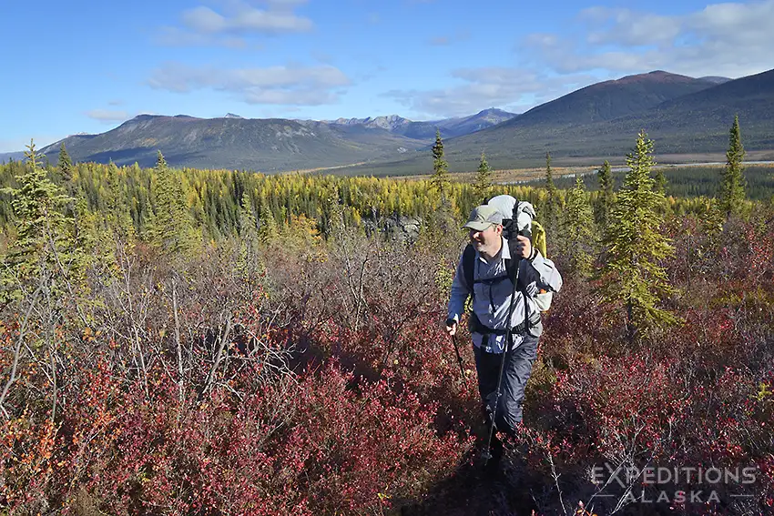
Most of the lowland travel involves navigating tussocks. These are clumps of Eriophorum vaginatum (cottongrass) that grow in saturated, permafrost-affected soils. They are unstable, wobbly mounds surrounded by wet muck. In the technical literature, this is known as the Arctic Thump. You cannot find a rhythm in the tussocks. Every step is a different height and every step requires a different balance point.
Rhane and I describe it as like trying to walk over a miles of funending (no, that’s not a typo) half-empty basketballs in fields sitting in water.
To travel efficiently, you have to find the highways of the Arctic. These are usually eskers, which are long, serpentine ridges of gravel deposited by ancient glacial meltwater streams. Eskers provide dry, firm footing and elevated views of the surrounding tundra. They are also the primary travel corridors for caribou and wolves.
Look for those.
Reading the vegetation is critical. Lighter green tundra usually indicates firmer ground, while dark, emerald green patches often signal deep, boot-sucking mud. You are constantly looking for the transition zones between the willow thickets and the dry ridges.
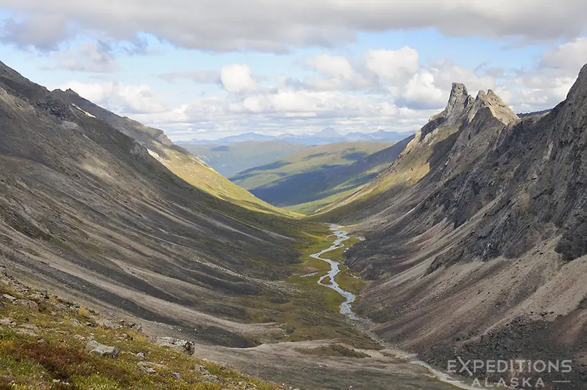
The Arrigetch Peaks: Granite, Gravity, and Relief
For those seeking technical relief, the Arrigetch Peaks are the most spectacular destination in the central Brooks Range. The name is Nunamiut for Fingers of the Hand Outstretched. While the rest of the Brooks Range is primarily sedimentary limestone and schist, the Arrigetch is a Cretaceous-age granite pluton. This is a massive intrusion of igneous rock that pushed through the surface about 100 million years ago.
Much of the approach to the Arrigetch from the Alatna River is an exercise in bushwhacking. You have to fight through dense thickets of alder and willow that can take a full day to navigate. Once you break above the brush line, you enter a high alpine world of 3 000 foot vertical walls and clear, turquoise tarns.
The weather here is notoriously localized. The peaks create their own clouds and rain, making technical navigation with a topo map and compass essential. This is a vertical world that feels more like the spires of Patagonia than the typical rolling hills of the Arctic.
ANWR and the Eastern Frontier: The Murie Legacy
When we move east from Gates into the Arctic National Wildlife Refuge (ANWR), the character of the backpacking experience changes. The mountains in ANWR are more compact. The distance between the boreal forest and the Arctic Ocean is much narrower. This creates a high density of landscape features. You can cross from a spruce forest, over a high mountain pass, and onto the coastal plain in just a few days of trekking.
The eastern range is the land of Olaus and Mardy Murie. Their 1956 expedition to the Sheenjek River was the catalyst for the creation of the refuge. They sought a place where the natural processes could play out without human interference. Backpacking in the Sheenjek or the Canning River drainage feels like a journey through the frontier of the range. The refuge they fought for remains the largest intact wilderness in the U.S. system.
The geology here is dominated by the Sadlerochit Formation, as documented by Ernest de Koven Leffingwell in his 1919 survey. He spent nine years on the coast, documenting the permafrost and the folding of the rock layers. The eastern range feels more urgent than the central range. The transitions between ecosystems happen faster and the presence of the coast is always felt in the wind.
Hydrology: Flashy Rivers and the Mystery of Aufeis
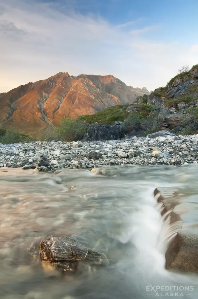
River crossings are the most significant objective hazard in the Brooks Range.
Rivers like the Alatna, the John, and the Canning are flashy and unpredictable. Even the Noatak River, a new favorite river of ours, can be dodgy. A heavy afternoon rain in the headwaters can cause the river levels to rise several feet in a matter of hours. You have to understand the hydrology of the North. You have to know when to wait and when to push.
You also have to contend with aufeis, or river icing. Barry Lopez described these as overflow glaciers.
They are massive sheets of ice that form when groundwater bubbles up and freezes in layers over the river channel during the winter. In the summer, these massive sheets of ice can persist, creating strange, crystalline landscapes in the middle of a tundra valley.
Navigating around aufeis requires care. We’ve seen aufeis turn riverbanks where we normally have an easy portage into untraversible, sketchy sheets of ice. The edges can be unstable and the water beneath is predictably frigid. It is a reminder that the Arctic is a landscape of frozen water, even in the height of summer.
The Ethics of the Brooks Range and the Reduction of the Ego
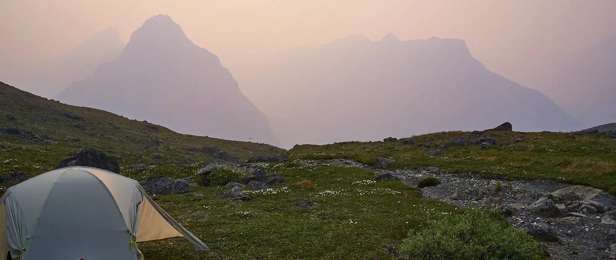
The definitive experience of a Brooks Range trip is the scale of the silence. Barry Lopez wrote about the mind of the landscape, and in the Brooks Range, that mind is profound. With a visitor density of roughly one person per hundred square miles, you are likely the only human in your drainage.
Success requires a reduction of the ego. You’re not conquering these mountains. You’re merely a guest in a 10 000 year old conversation between the ice, the rock, and the animals. This is what an arctic camping trip feels like.
Your safety depends on your judgment.
There’s no rescue team around the corner. You must manage your own risk, your own navigation, and your own pace. The reward is what Robert Marshall described as the joy of the uncharted. It is the rare opportunity to engage with a world that remains exactly as it was when the first hunters looked out from the Mesa ridge 12 000 years ago. It is a landscape that demands everything from you and offers absolute solitude in return.
Planning a Brooks Range Backpacking Trip
There are no trailheads in the Brooks Range. Access is usually by bush plane, typically from Fairbanks via Bettles or Coldfoot. You fly in, the pilot leaves, and you walk out to a predetermined pickup point days or weeks later. This is not logistically simple, and it is not cheap. But it is the only way in.
Other folks will walk in from the Dalton Highway. You can walk west from the Dalton into Gates, or east to the Arctic National Wildlife Refuge. Either will work. Some folks will fly to Anakutuvuk Pass and walk in from there. It’s doable. Our guides Rhane and Rachel did this several years ago exploring some trips we run. It’s a bit of a mission but can save you the costs of the air taxi.
If you’re heading in to Gates of the Arctic National Park, you should read this post for info on how to get to the park and see the Brooks Range.
The backpacking season runs from late June through early September. June brings continuous daylight and high water from snowmelt. July offers the best weather window but also peak mosquitoes. August brings fall colors, diminishing bugs, and the first risk of early snow. By mid-September, winter is arriving.
Most people who attempt the Brooks Range independently underestimate it. The terrain is relentless, navigation is constant, and there is no margin for error. River crossings can become impassable in hours very quickly. Watersheds are huge up here. Packrafting down the Itkillik one year we were amazed at how drastically the river rose one night while we slept. We saw very little rain in our vicinity, but the river came up 3 feet overnight. Camp and plan accordingly.
Weather can pin you down. Trevor saw heavy snow and slab avalanches in late July one summer while backpacking the Northern Traverse.
This is not the place to test new systems or break in new boots. As Trevor found out, it’s also not the place to borrow a test you haven’t tested yet. If you do not have extensive experience in remote, trailless wilderness, go with a guide. The consequences of poor judgment here are not abstract.
For those with the skills and preparation, the Brooks Range offers something almost extinct in the modern world: a landscape that asks everything of you and gives nothing but itself in return.
If you’re interested to know more about a Brooks Range Expedition, Drop me a note →